
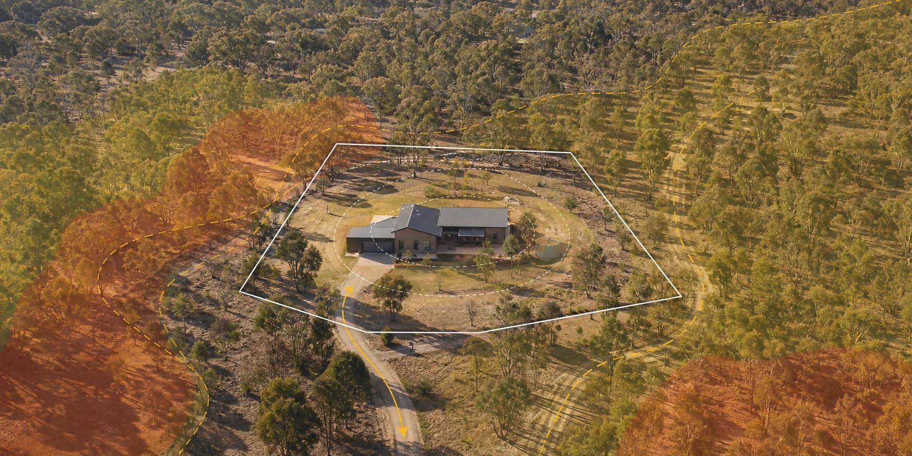
A bushfire constraint is easy to treat as a late technical report. The sketch is complete, the yield has been tested, the client likes the elevation, and then a BAL assessment or bushfire referral starts pulling on the whole scheme.
For planners, architects and developers, that sequence is risky. Bushfire is a site-planning constraint before it is a construction specification. It can affect the building envelope, subdivision pattern, access, defendable space, vegetation retention, water supply, consultant scope and approval pathway. If those checks happen after the concept is sold, the redesign is often more expensive than the early due diligence would have been.
Start with the planning trigger, not the facade
The first question is not "what cladding will achieve this BAL?" It is whether the parcel is affected by a bushfire planning control or hazard map, and what that means for the site layout.
In NSW, the Rural Fire Service explains that bush fire prone land maps are prepared by councils and certified by the RFS Commissioner. A section 10.7 planning certificate should note whether a property is bush fire prone, and councils can amend their maps as conditions change. NSW Planning also states that development on bush fire prone land must meet Planning for Bush Fire Protection 2019 unless the consent authority has consulted the RFS. Subdivision and special fire protection development on bush fire prone land require a bush fire safety authority under section 100B of the Rural Fires Act 1997.
Those are design-program facts. A subdivision concept may need different lot depth, road geometry, perimeter access or asset protection zone assumptions before anyone debates architectural style. A school, seniors housing project or other special fire protection use may need referral timing built into the approval strategy from the beginning.
NSW is also in a live policy cycle. The RFS says Planning for Bush Fire Protection 2019 remains the current legislated version while its review incorporates advances in fire science and lessons from Black Summer. The RFS has identified public exhibition and finalisation milestones through 2026, and PBP addenda already include a 2025 addendum for Class 9B schools on bush fire prone land. For longer-running projects, the due diligence memo should record the current source date and any sensitivity to guidance changes.
In Victoria, the BMO is a design brief
Victoria's Bushfire Management Overlay is not a note to leave for the building surveyor. Planning Victoria describes the BMO as applying to land that may be significantly affected by extreme bushfires. Its guidance says a bushfire management plan can specify the BAL, setbacks, defendable space, water supply and emergency access.
That list reaches straight into the architect's base plan. Setbacks can shift the buildable area. Defendable space can change tree retention, garden structure and the relationship between private open space and retained vegetation. Emergency access can affect driveway gradients, turning areas and internal road widths. Water supply can change service locations and the way a rural or edge-site entry is organised.
For planners, the BMO also changes the quality of the pre-application conversation. A stronger early pack does not simply say "BMO applies". It shows the likely design consequences: where the hazard interface sits, what vegetation assumptions need testing, which areas may be hard to defend, and what a bushfire consultant should confirm before the application narrative hardens.
Queensland points to avoidance and mitigation in the layout
Queensland Fire Department's bushfire resilient communities guidance frames land-use planning as a way to avoid or mitigate bushfire risk by incorporating bushfire-resilient design features. For a planner or developer, that means the early scan should cover state and local hazard layers, nearby hazardous vegetation, slope, access redundancy, water availability and whether the proposed use places more vulnerable occupants in a constrained location.
The practical lesson is not that Queensland, NSW and Victoria have identical rules. They do not. The lesson is that bushfire mapping should be read as a design input in every jurisdiction. If the first concept uses the most exposed corner of the site for the main building, assumes a single tight access point, or relies on vegetation that may later conflict with defendable space, the project team has created avoidable risk.
BAL affects construction, but site choices influence BAL exposure
A BAL rating should come from a qualified assessment, not a desktop blog post or a generic platform screen. Still, architects and feasibility teams need to understand why BAL belongs in the first round of design questions.
Standards Australia released new bushfire construction handbooks in May 2026 for practitioners and homeowners and noted that revision of AS 3959 is progressing. AS 3959 sits behind the familiar construction response to bushfire attack levels. Once a BAL is assessed, it can influence windows, doors, roof detailing, subfloor treatment, external walls, decks, screens and other assemblies.
The mistake is treating those requirements as a shopping list after the footprint is fixed. BAL exposure is tied to site conditions such as vegetation, slope and separation. Early siting choices may reduce exposure or make a compliant, buildable response more realistic. Poor siting can push the project into higher-cost details, narrower material choices and harder documentation.
Six checks before concept lock-in
Before a planner issues a pre-lodgement pack, an architect presents the preferred concept, or a developer signs off a feasibility yield, run these checks.
- Confirm the trigger layers. Check bushfire-prone land, BMO or equivalent state and local hazard controls, and record the source date.
- Test the building envelope. Compare the preferred siting against vegetation, slope, likely defendable space or asset protection zone needs, and future staging.
- Stress-test access. Ask whether emergency access, egress, road width, turning, gradients and maintenance can be solved without sacrificing the scheme later.
- Reconcile vegetation with other constraints. Do not assume the answer is to clear everything. Native vegetation, biodiversity, neighbourhood character and permit controls may limit what can be removed.
- Flag water and services early. Firefighting water supply, hydrant reach, tanks, pumps and service locations can all affect layout, especially outside fully serviced urban areas.
- Brief the right specialist before the pretty render. A BPAD-accredited or otherwise suitably qualified bushfire consultant can test assumptions before the project team commits to form, cost plan and approval pathway.
Where Enviro-D fits
Enviro-D can help project teams screen a parcel before concept design starts: bushfire-prone land and BMO-style signals where available, state and local hazard layers, nearby vegetation context, source links and prompts for consultant questions. Used well, that first pass becomes a short design-risk memo for the planner, architect, development manager and bushfire consultant.
It does not provide a BAL rating, certify compliance, replace a planning certificate, or stand in for a bushfire assessment, council advice, legal advice or consent authority decision. Its value is earlier triage: spotting the bushfire questions while the footprint, access and planting strategy can still move.
If a site is in a bushfire-prone or overlay-affected area, run the Enviro-D screen before the first massing option becomes the preferred design. Then brief the bushfire specialist with better questions, clearer maps and fewer hidden assumptions.
Sources and further reading
- NSW RFS, Planning for Bush Fire Protection
- NSW Planning, Bushfire development regulations
- Victoria Planning, Building in the Bushfire Management Overlay
- Queensland Fire Department, Bushfire resilient communities
- Standards Australia, Helping build resilience: new bushfire handbooks